|
Client: Town of Apex Electric Utility Division
Electric Utility Infrastructure GIS Utility Map Development
SGS constructed a geodatabase and created a customized GPS data collection protocol designed to produce a GIS inventory of the electric utility infrastructure for a municipal power provider. The geodatabase design was centered on infrastructure equipment informational needs as outlined by utility personnel. The geodatabase design was paired with a customized GPS data collection protocol developed to capture all relevant field data for population of the geodatabase. Overhead and underground electric utility devices were mapped from distribution substations to service pedestals. SGS currently maintains the GIS utility map via quarterly maintenance efforts.
The geodatabase design for this project was structured with specific end-user modeling interests and engineering analytical functionality interests in mind. Electric device features reside in the geodatabase as separate features to provide for separate behavior in modeling scenarios (at a given utility pole coordinate location multiple devices exist as separate features: expulsion fuse, single phase transformer, etc). The geodatabase was also designed specifically for interfacing via export with the Milsoft Utility Solutions engineering analysis program WindMil. Electric devices and conductor features in the model are provided a parent-child connectivity relationship significant to engineering analyses within WindMil. A GIS geodatabase to Milsoft data format conversion protocol was designed by SGS based on Milsoft specifications. This protocol allowed the utility to avoid costly implementation expenses associated with WindMil that arise when Milsoft handles the procedure of converting a geodatabase into a format functional within WindMil.
The resultant GIS represents the integration of electric device equipment information previously only retrievable via field visits and drawers-full of highly detailed hand drawn underground electric utility plans into one seamless utility wide map. In addition to the multitude of functions inherent to the GIS, the conversion of data to functionality within WindMil creates a powerful assessment tool to help electric utility providers comply with the National Electric Safety Code (OSHA sites NESC as the standard when enforcing utility electrical safety).
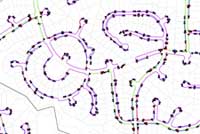 |
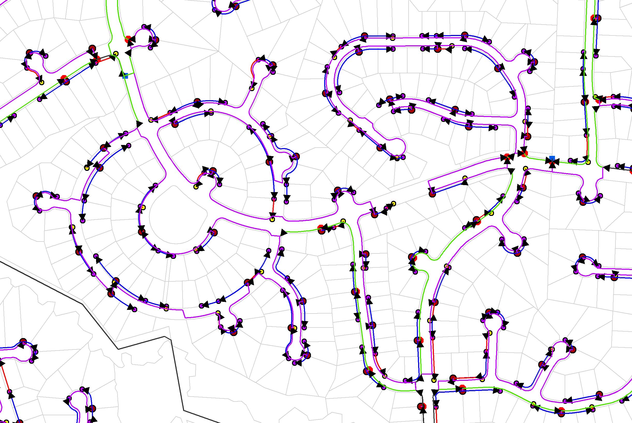
Underground service area |
|
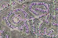 |
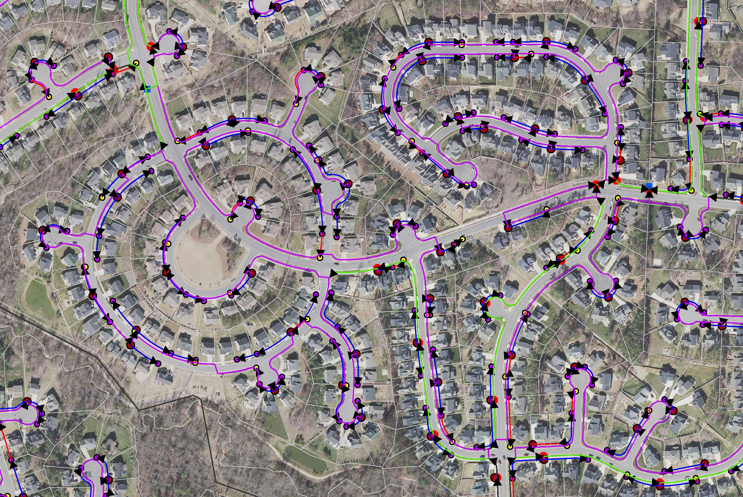
Underground service area with aerial photography |
|
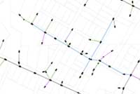 |
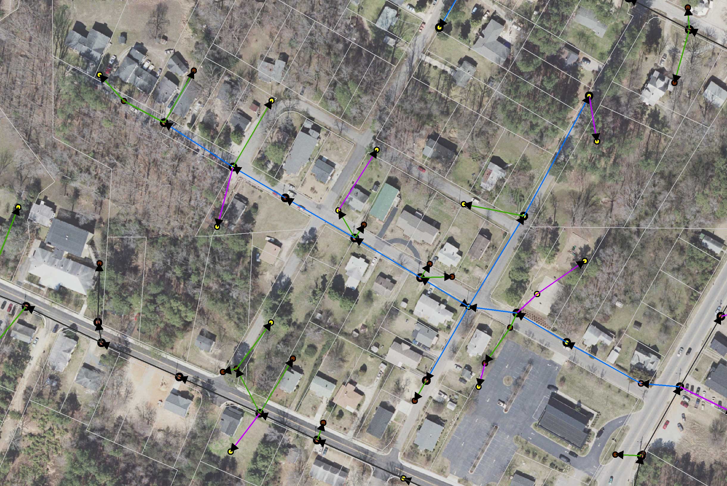
Overhead service area |
|
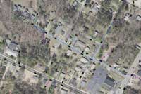 |
Overhead service area with aerial photography |
|
|