Southern Geospatial Services, PLLC
124 Salem Towne Court Suite B
Apex, NC 27502-2311
NCBELS Firm License P-1373
919.810.2005
info@sgsgis.com |
|
 |
 |
Below is a sampling of projects we have worked on to date.
Click on a title to view details.
|
Electric Utility Infrastructure GIS Utility Map Development
Geodatabase development and GPS mapping to generate a GIS inventory of electric utility infrastructure for a municipal power provider.
|
 |
Stormwater Utility Infrastructure GIS Utility Map Development
Geodatabase development and GPS mapping to generate a GIS inventory of stormwater infrastructure for a municipal separate storm sewer system (MF4) operator to satisfy NPDES Phase II Stormwater Program requirements.
|
|
Water Utility Infrastructure GIS Utility Map Development
Geodatabase development and GPS mapping to generate a GIS inventory of water utility infrastructure for a municipal water service provider. |
|
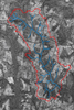
NC County Soil Survey Map Rectification
A spatial database was generated of stream networks as represented in North Carolina County Soil Survey publications for select research watersheds. Specifically, historic hardcopy soil survey maps were scanned and georeferenced based on current reference images, and the stream networks were digitized as displayed on the rectified soil maps. |
 |
Tree Inventory and Health Monitoring Along a Pipeline Easement
GIS inventory and health monitoring of high value trees in a Pinetum related to construction along a pipeline easement.
|
|
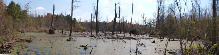
Stream Identification and Mapping Project
Field surveys were performed to map stream networks in select research watersheds across North Carolina.
|
|
Jurisdictional Wetlands and Streams Desktop Predictive Analysis
Due diligence pre-development site investigation. Combined various digital imagery sets, GIS and hardcopy NC County Soil Survey maps, LIDAR data, FEMA flood insurance rate maps, USGS Topographic maps, and various additional GIS datasets to predict the presence of jurisdictional wetlands and streams at a proposed development site in Carteret County. |
|
|
 |
© 2014 Southern Geospatial Services, PLLC |