|
Client: Town of Apex Operations Division
Water Utility Infrastructure GIS Utility Map Development
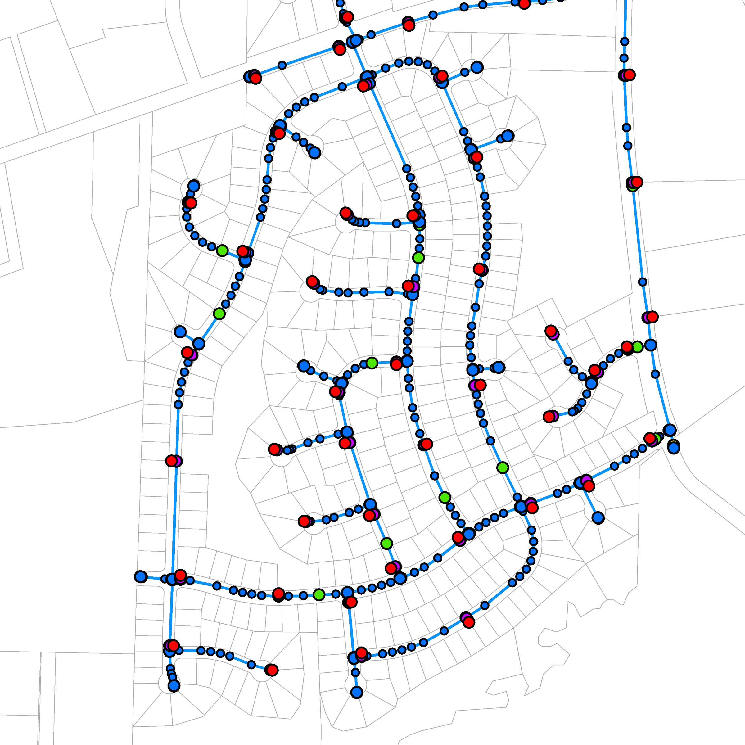
SGS constructed a geodatabase and created a customized GPS data collection protocol for a municipal water service provider. At the request of the utility, locates for the project were performed in house and thus Utility staff performed locates of water utility pipes and fittings prior to SGS mapping efforts. Utility staff also exercised valves to verify sizes and that information was incorporated as part of the locate effort. GPS features were collected at water utility infrastructure locations including fire hydrants, valves, air release manholes, blow offs, mechanical fittings, etc. Deflected water lines were mapped every 40' within neighborhoods and every 80' along main roads to incorporate the curvature of deflected water lines into the GIS. SGS examined construction drawings to assist with field mapping efforts and the drawing of pipeline features. Line features were created within the GIS to represent water pipeline features, and pipeline features were provided with size and material information as collected in the field. Thorough communication with the utility provider was used to resolve discrepancies between construction drawings and the utility as installed.
This project is ongoing.
|