|
Client: NCDWQ via NCSU Dept of Forestry and Environmental Resources
Stream Identification and Mapping Project
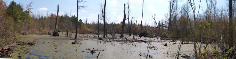
Field surveys were performed to map stream networks in select research watersheds across North Carolina. Trimble GPS units were used to record coordinate information at locations every fifty to seventy five feet along the stream channel from the watershed mouth to all perennial and intermittent stream origins. Stream origin determination was based on NCDWQ stream identification techniques utilized for riparian buffer rule applications (NCDWQ 2005). Project performed for North Carolina State University Department of Forestry and Environmental Resources research effort (Colson et al. 2006) funded through the North Carolina Division of Water Quality.
References:
NCDWQ (2005), Identification Methods for the Origins of Intermittent and
Perennial streams. Version 3.1. North Carolina Department of Environment
and Natural Resources, Division of Water Quality, Stormwater and Wetlands
Branch, Raleigh, NC.
Colson, Thomas P., James Gregory, Stacy Nelson, Edward Shipman (2006), A
Mobile Geographic Information System to Support Stream Identification In:
Proceedings, Geographic Information Systems and Water Resources IV AWRA
Spring Specialty Conference; Houston, Texas; May 8-10, 2006.
Acknowledgements:
The methods and results reported here and in NC County Soil Survey Map Rectification are part of an ongoing study “A Mobile Geographic Information System to Support Stream Identification”, P. I. James D. Gregory. The research is a cooperative effort with the Plans and Policy Unit, Stormwater and Wetlands Branch, NC Division of Water Quality, NC Department of Environment and Natural Resources. PI and other investigators acknowledge the support of unit supervisor, John Dorney and staff members Steve Kroeger and Periann Russell. Southern Geospatial Services acknowledges the support of the principal investigator, James D. Gregory, as well as Thomas P. Colson, for the use of their research on this website, and for the opportunity to assist with this project. Funding support is provided by the NC Department of Environment and Natural Resources and the North Carolina Agricultural Research Service, NC State University.
|