ESRI data model (personal geodatabase) development
SGS can custom design or modify an existing ESRI template data model design to suit most project needs.
High accuracy (sub-foot) GPS mapping services
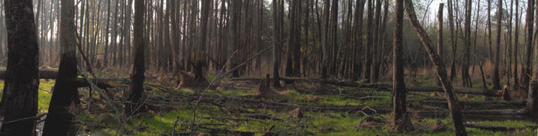
SGS provides GPS mapping services with post-processed sub-foot horizontal accuracy using Trimble GeoXH GPS units. SGS specializes in utility infrastructure GIS map creation, perennial & intermittent stream mapping, and jurisdictional wetland delineation (see below). In addition we will map anything that can be mapped via GPS: streets, sidewalks, greenways and bike trails, agricultural fields, arboretum inventories, etc..
GPS data to GIS database integration services
For any project, SGS will design a data model around client informational needs. We will sit down with you to figure exactly what is to be mapped, how we can best incorporate these elements as features in a database, what aspects of each feature require information to be collected (attributes), and what data will potentially fill various attribute fields for each feature (attribute domains). This information is used to construct a customized GPS data collection protocol developed to capture relevant data for populating the data model. This paired system allows for a simplified data loading process of the GPS data format into the GIS data model.
Utility infrastructure GPS/GIS inventory mapping and consulting services
SGS created a stormwater infrastructure basemap to satisfy NPDES Phase II Stormwater Program requirements for a municipal separate storm sewer system (MS4) operator [see completed project]. SGS is currently involved with creating an electric utility infrastructure GIS basemap for a municipal power provider [see completed project].
SGS has the capability to utilize the first three services detailed above to either create a GIS infrastructure basemap for an MS4 operator, municipal power provider, or electric cooperative, or SGS can consult with the provider to help them design and implement a customized plan to develop and maintain their own GIS basemap.
For electric utilities, a GIS provides countless capabilities. Examples include the ability to query equipment information anywhere in the utility from the office, make conductor length calculations not previously possible, analyze device inventory, determine the age of equipment, etc. If devices are replaced, SGS can provide standard operating procedures for managing edits within the database, or agreements can be made where SGS manages the edits periodically. Depending on the interests and budget of the utility, mobile solutions are possible where workers in the field can have the same capacity to query the database as a manager at the office.
In addition to the multitude of functions inherent to the GIS, if combined with engineering analysis software the GIS can become a powerful assessment tool to help electric utility providers comply with the National Electric Safety Code. Read the project experience description Electric Utility Infrastructure GIS Basemap Development to learn more about how SGS customized a data model for interfacing the GIS via export with the Milsoft Utility Solutions engineering analysis program WindMil.
The main impetus from the MS4 operator perspective is to satisfy NPDES Phase II Stormwater Program requirements if designated. Regulations require “Complete identification, locations of and mapping of stormwater drainage system components. At a minimum, mapping components include outfalls, drainage areas and receiving streams.” Regardless, a stormwater basemap is a critical aspect of developing and maintaining an overall stormwater management plan, and represents a huge improvement over a reliance on paper maps of various scales.
Data acquisition & data creation services
GIS data crucial to project success can exist in various locations that can be difficult to track down. Datasets such as parcel data, soils data, wetlands data, aerial photography, LIDAR (Light Detection and Ranging data), Digital Elevation Models (DEMs), rainfall data, flood data, land use data, streets data, and countless others are spread across the internet. SGS has the knowledge to acquire this data for any project we work on or provide it for any project needs your company may have. SGS maintains in storage many Gigabytes of data especially relevant to North Carolina projects.
In addition to acquiring data, SGS has the capability of generating high resolution DEMs (to 5’) from LIDAR data, creating parcel or other data from COGO (coordinate geometry) survey information, and creating GIS datasets of anything that can be mapped via GPS: streets, sidewalks, greenways and bike trails, wetlands and streams, agricultural fields, arboretum inventories, etc.
GIS based land use/land management planning services
Using the variety of GIS data sources that are available, SGS can assist in land use and land management plans such as targeted conservation management plans for county and municipality governments experiencing high development rates.
Jurisdictional wetland GIS desktop delineation (due diligence pre-development site investigations)
SGS can help developers estimate the extent of jurisdictional wetlands and streams within a proposed development site without taking on the expense of an onsite jurisdictional determination. Due diligence pre-development site investigations involve the combination of various digital imagery sets, digital and hardcopy NC County Soil Survey maps, LIDAR elevation data, FEMA flood insurance rate maps, USGS Topographic maps, and various additional GIS datasets to make the estimation and provide developers with a thorough information base regarding the property.
Jurisdictional wetland determination and GPS delineation (CWA Section 404/401)
SGS can perform onsite jurisdictional determinations, delineate wetlands, map them via GPS, and provide the data in GIS and hardcopy format. SGS staff successfully completed the North Carolina Jurisdictional Wetland Determination and Delineation certification course instructed by the NC State University Department of Forestry and Environmental Resources.
Stream identification and GPS mapping services (with respect to riparian buffer regulations)
SGS can identify stream origins based on NC Division of Water Quality stream identification techniques utilized for riparian buffer rule applications, map the streams via GPS, and provide the data in GIS and hardcopy format. SGS staff successfully completed the Intermittent and Perennial Stream Identification for Riparian Buffer Rules North Carolina certification course instructed by the NC State University Department of Forestry and Environmental Resources and the NC Division of Water Quality Stormwater and Wetlands Unit.
Photogrammetry services
SGS can convert non-georeferenced hardcopy and digital aerial photography datasets into rectified seamless photomosaics. Hardcopy photography datasets are scanned using high resolution large format scanners. SGS can interpret and analyze aerial photography datasets, including vegetation classification polygon delineation, and can analyze and other remotely sensed (RS) data formats.
Standard GIS analyses, publication quality GIS map production
SGS staff have years of experience with GIS. If we don’t know how to perform a particular task within a GIS, we can learn. Sam Taylor, GIS Specialist and founder of Southern Geospatial Services, has worked with GIS for over 6 years and holds a Masters degree from NC State University in Natural Resources and Spatial Information Science (GIS).